 |
|||||
Main>Articles>Military Stuff>Space-Based Imaging Capabilities
Space-Based
Imaging Capabilities
MACsat
MACsat (Medium
Aperture Camera Satelite) is a second-generation earth observation satelite
jointly developed by Malaysia and South Korea. Scheduled to be launched
sometime in 2004, MACsat will provide Malaysian authorities pictures at
a resolution of 2.5 meters. This means that any object larger than 2.5
meters will be able to be resolved by the optics and possibly identified.
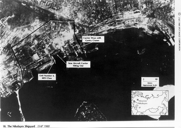
The image below shows a sample 2.5m resolution picture taken by the French
SPOT satelite.

Without a large orbital propulsion system, the MACsat will not be able to venture from its Near Equatorial orbit and take images of locations not covered by its footprint. However, since Malaysia's intelligence imagery needs seldom reaches beyond regional boundaries, this limitation will not be significant. As demonstrated by the above image, MACsat should be able to provide Malaysia with valuable military intelligence, especially in peacetime, when recon aircraft overflights are a big no-no. MACsat images will show naval ships at their piers, the layout of military installations, troop concentrations and other various information on the military activities of her neighbours. Orbiting at an altitude of 685km, MACsat is beyond the reach of any SAM system and can provide defense planners with almost real-time intelligence imagery. With up to 15 passes each day and a lifetime of at least 3 years, MACsat will be an important stepping stone as Malaysia strives to improve its space imaging capabilities.
Near Equatorial
Low Earth Orbit (NEqO) Constellation
 NEqO
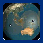
is a plan by ATSB Sdn Bhd of Malaysia to place a constellation of 8 small
satelites into Near Equatorial Low Earth Orbit. With eight satelites,
there can be a guarantee that at least one of them will be over the region
at any time. These satelites will perform a variety of tasks including
Earth observation and digital communications relay. This is to serve the
needs of various sectors in Malaysia including intelligence, health, agriculture,
natural resource and environmental management and education sectors. With
a multi-function payload which include transponders for communications
purposes and optical equipment for Earth observation, the NEqO constellation
will be able to benefit many at a lower cost, thus saving valuable resources.
The presence of at least one satelite above Malaysia at any moment will
ensure that military planners will be able to have access to real-time
imagery at all times. NEqO will continue to provide valuable technological
expertise to Malaysian institutions as they cooperate with foreign institutions
on the development of the constellation.
TiungSAT-1
 With
a maximum resolution of 78 meters, TiungSAT's optical package is not expected
to provide any meaningful intelligence data. It is more of a technology
demonstrator for satelite technology developed jointly by ATSB Sdn Bhd
of Malaysia and University of Surrey in UK. It's optics is more suited
for pollution monitoring, mapping, oceanography and other civilian purposes.
It's other payloads include HAM radio experiments and an experimental
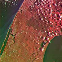
flywheel as a tech demonstrator. The image on the right shows a picture
taken by TiungSAT-1 of Miami, USA. It is obvious that no useful military
intelligence can be gained from an image of this resolution. However,
TiungSAT-1 is vital since it was Malaysia's first attempt at satelite
construction and has provided Malaysia with a great amount of experience
and expertise in satelite fabrication as well as mission control.